
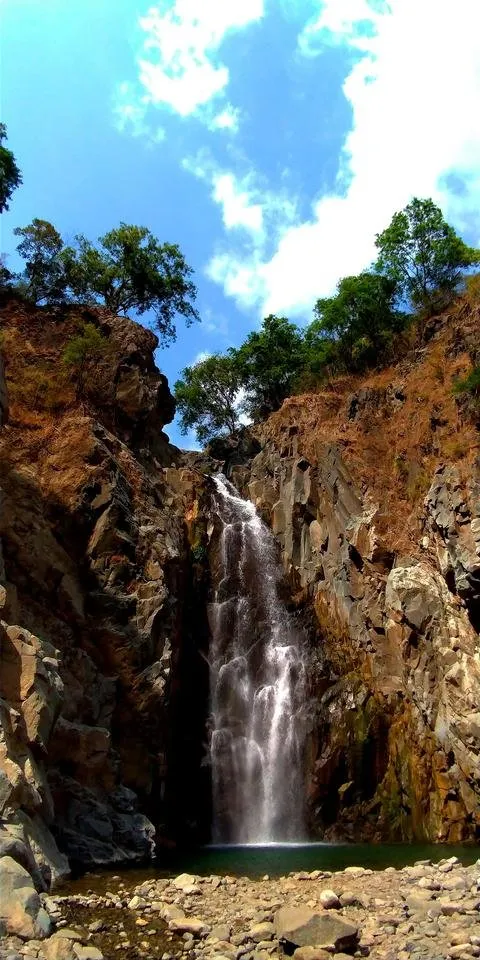
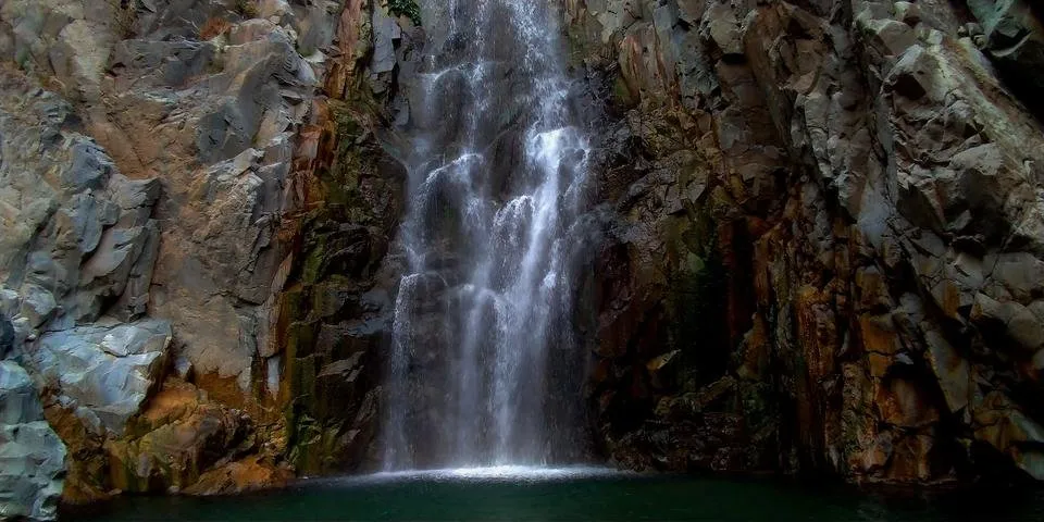
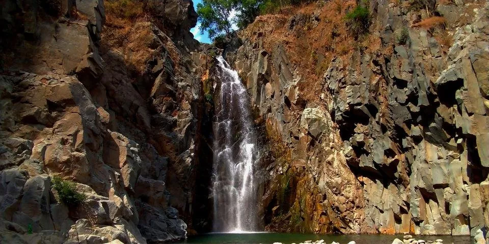
On my last post, I did a post comparing how Hydro 1 looks now than before. This time, let's take a visit to Hydro 2. Hydro 2 is located a kilometer or so away from Hydro 1. I like coming here because how amazing it is to watch the three-tiered waterfall.
I had a view of the extent of restructuring nature had done to Hydro 2 when we went to the water district reservoir last January.
This is how the hanging foot bridge looked last year, 11 months ago. Check out this blog
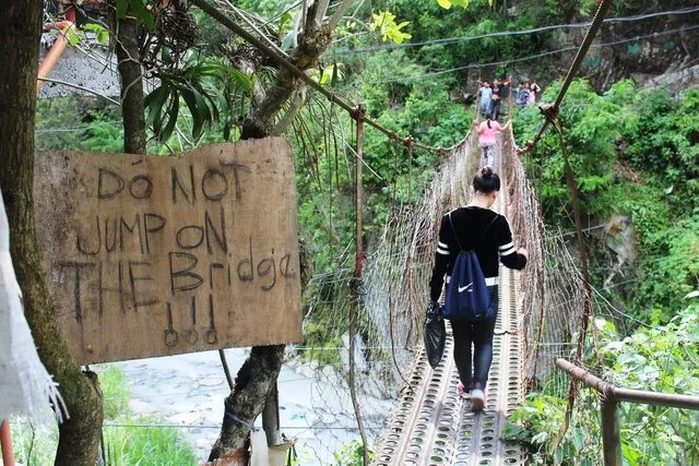
This is how it looks now.
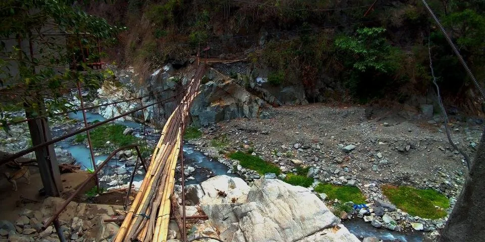
It still looks rickety and likely to break any minute but surprisingly, it has held on sturdily. Bamboos were used to serve as walkways. I was really skeptic when I saw it and for a minute was fearful of crossing it because of how it was poorly patched up but thankfully it held on. It is at least a 10-foot drop or probably more so I have every right to be scared lol!
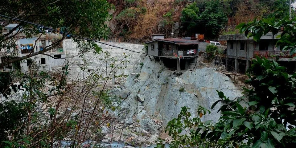
Again, as it was in Hydro 1, the houses and parts of the road nearest the water suffered the most, breaking the foundation on which these structures were built. I mentioned here in this blog ULOG #54: Nature's Revenge what brought about such change. Typhoon Ompong (Mangkhut) happened. It is one of the powerful tropical cyclones that hit our country.
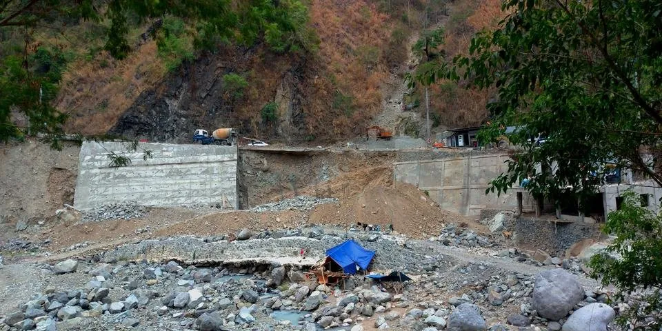
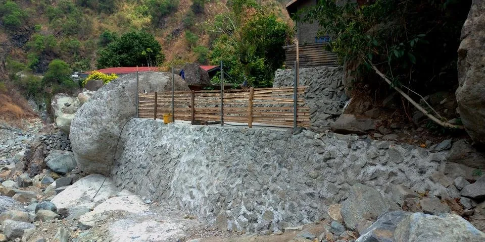
A wall has been put up on the way going to the waterfalls to hopefully protect the remaining houses built on the banks of the river.
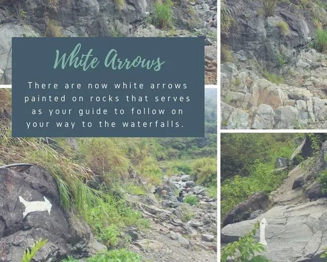
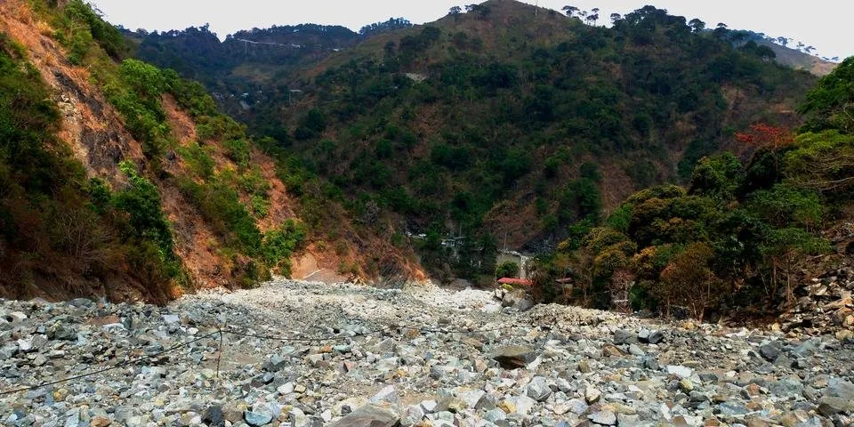
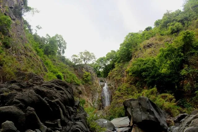
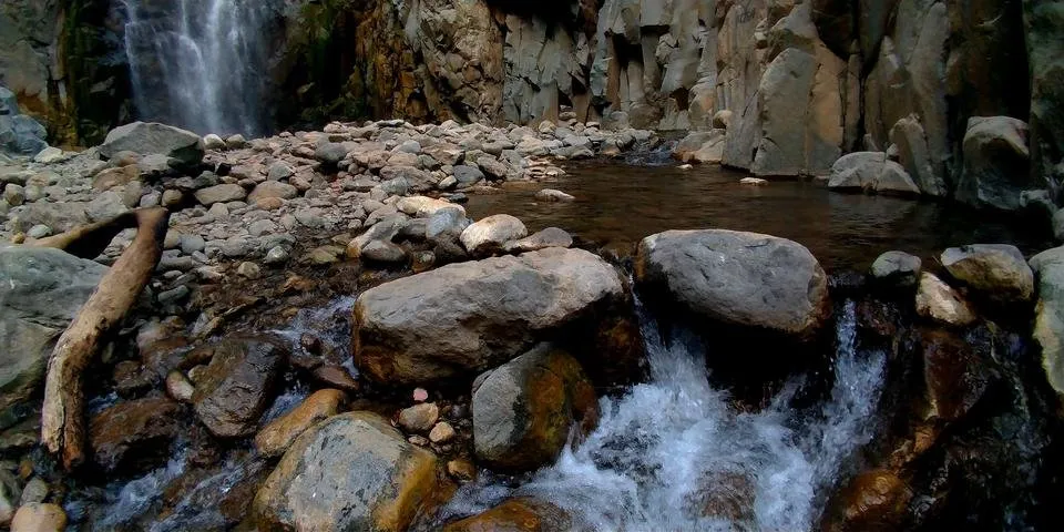
There used to be pools of water that we have to cross, boulders that we have to climb, tall grasses and weeds we have to fight with to get to the waterfalls. There used to painted arrows pointing the way to the waterfalls.
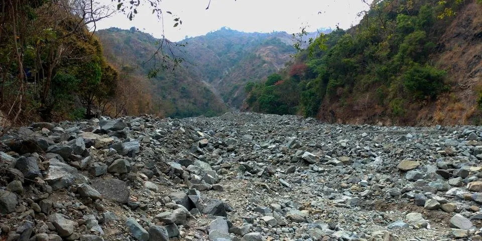
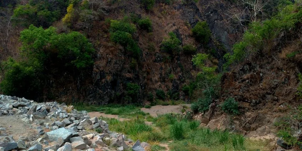
Today, this is how the river looks. No trace whatsoever of how it used to be. It is just a flat bed of rocks.
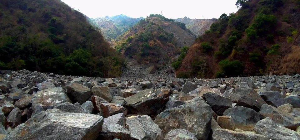
It was on this area that getting to the waterfall can be a struggle for some because we have to scale a rock wall. Notice the black rocks on the left of the photo. Sometimes, when the water level is high, we cannot even get across it.
Now, there is no trace of those rocks we have to climb because it is covered with sand.
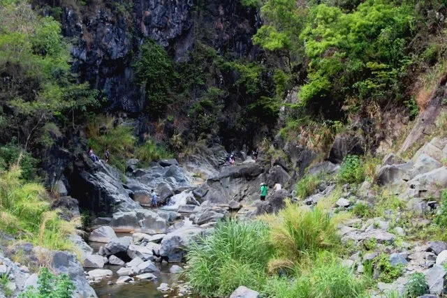
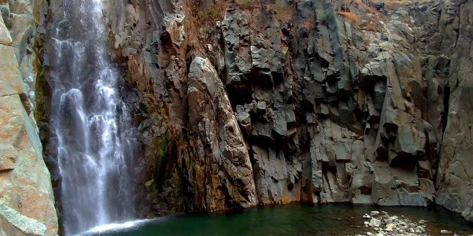
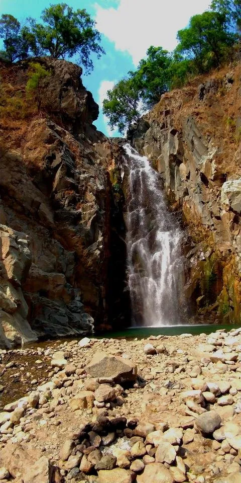
I like this spot because when you turn that bend, you will see the beauty of the three waterfalls. It is where I sit and admire this natural wonder. The top falls is almost hidden that you thought there were only two falls. Also, it is way smaller than the last two. I also like the big rocks that seem to stand as guards on the banks of and in the river as you go upstream.
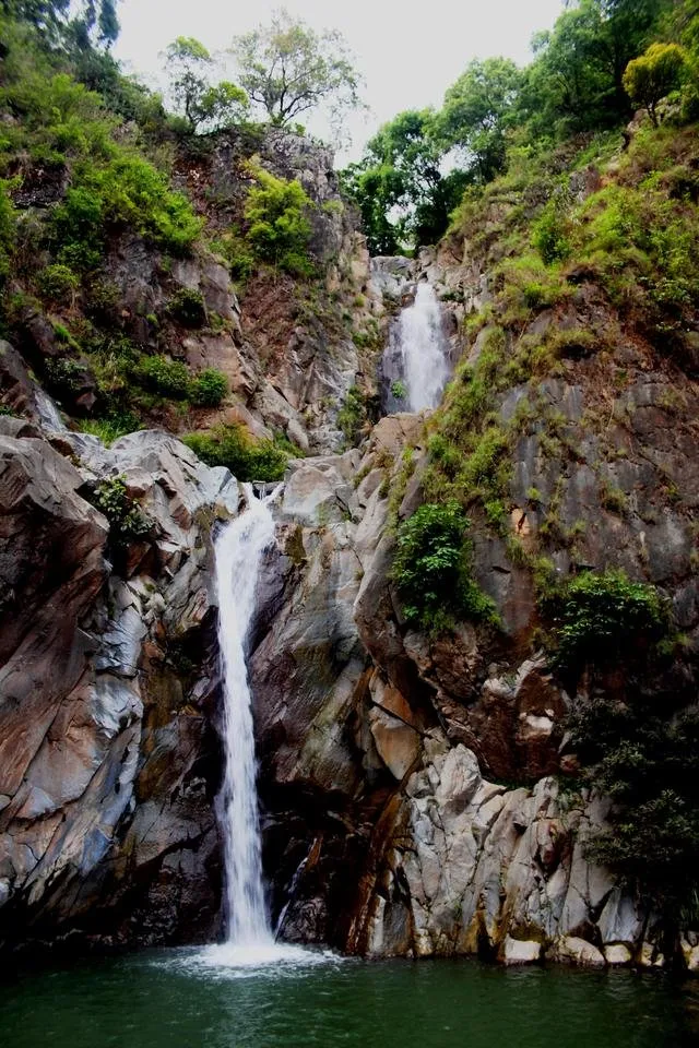
This is what greets you now when you reach that spot.
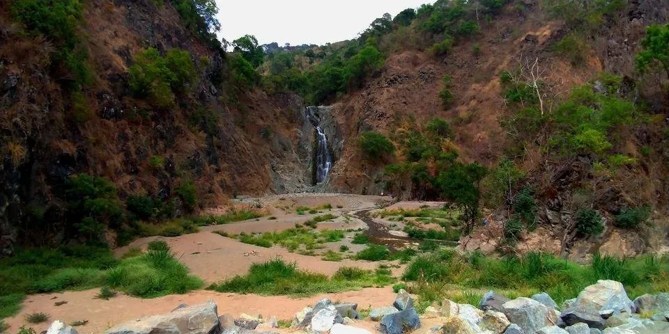
Notice the course of the water changed even. It used to run straight down to where I took the photo but now it curves toward the right finding a way into the mountain.
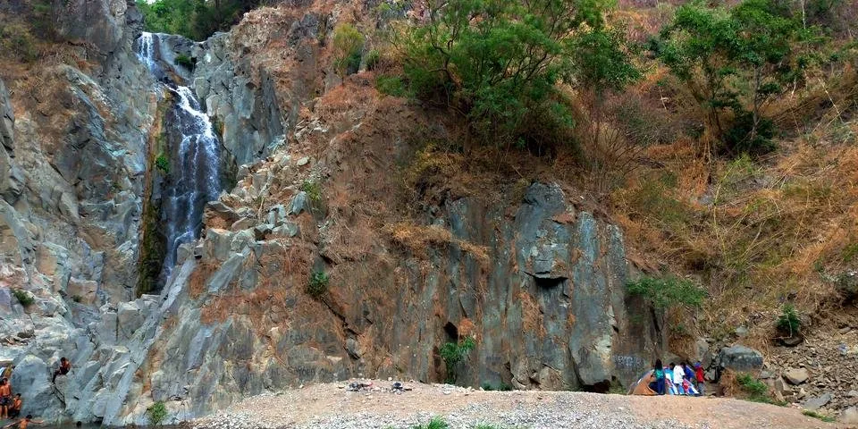
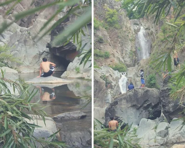
There were already kids that can see n from afar. As I got nearer, there were even more swimming in the pool. This pool used to be wider and this place had no sand that you can camp. The pool used to be deeper, too, so there were only a few who come to this place and swim. Now that everything has changed, everybody seems to be here.
The height of the last waterfalls was cut in half. Only the majesty of the second waterfalls remained. Also, it is an easy access going to the second waterfalls whereas before it was a real challenge for you have to climb up a rocky and crumbling path and then go down a steep and slippery path. It is risky and not advisable. Today, you do not have to worry getting there. It seemed like nature gave free access to this waterfalls.
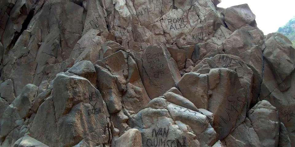
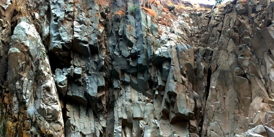
And just like that, many have already etched their names on whatever rocks they can reach.
Because of its easy access and it is now "safer" to swim, people come here to camp and build campfires, swim, drink and be merry, enjoying Hydro 2 in a different light.
Here are few short clips:
I can only wonder how such change can happen. I am in awe. It is mind boggling how this river can be changed this way. I cannot imagine the immensity and the force of the water. It is humbling to know that nature can be this powerful. A terrifying and stunning yet impressive display of strength.
Despite that it makes it easier to get to the waterfalls now and the sand washed by the river that settled around the waterfalls gave a perfect place to camp. I like it this way better surprisingly because it is now more accessible and easier to go to the waterfalls.
!steemitworldmap 16.364327 lat 120.598890 long Hydro 2 Waterfalls d3scr